Home
Home Up
Up Search
 Mail
Mail
NEW
Google Earth and accurate skyline profiles
I have been playing somewhat more with Google
Earth (GE, free and Pro version 4.0.2091) from the standpoint of
finding
directions between a location of a person/neolithic monument
(like at Maeshowe)
and a
certain geographical feature at a medium distance (say between 2
and 15
km). This could be important in archaeoastronomy
research.
The perspective I take is that I would like to see the skyline
profile
accurate
enough (azimuth and altitude accuracy better then 0.25 degrees)
from a
person's eye height level. I have other wishes like being able to
model
the monument and involve
the
movements of the celestial bodies, but I leave that
for another page.
Here are some ideas that popped up while studying GE:
- I understand that GE
uses
WGS84
longitude/latitude. Although GE is using a
simple map projection, the real errors are small for medium
distance
directions (I assume).
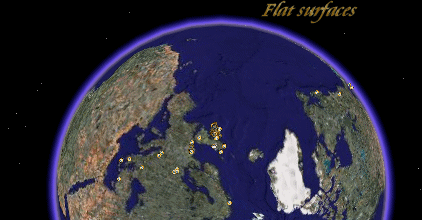
- GE is not using a real WGS84 geod to map the
terrain imagines (it uses a approximation of a sphere by using
several
flat surfaces [oblate spheroid], like most 3D programs
do).
- The height is refered
to
sea
level (<altitudeMode>: tidal
datum), thus not
according to WGS84 ellipsoid but EGM96 geoid. Also here there
will be
some error due to sea
level instead of geodetic datum, but in medium regions (up to 10
km)
and not too large height difference (say less than 1 km) no real
errors
will occur.
So I assume the eye
alt (as seen in
the status bar) determined from the tidal datum and not from
the oblate spheroid surface.
There is a difference between
the 'eye alt. based on oblate spheroid' and 'eye alt based on
tidal
datum'. The 'eye alt. based on tidal datum' is closer to the
correct
one (which is 'eye-alt
based
on geodetic datum').
- A calculator to translate sea level height (based
on
EGM96 geoid) into WGS84 can be found here.
- There are known
errors
in the mapping of the terrain imagines to
the grid. I have no ideas about these errors, so in some way I
prefer
to use my
own GPS measurements instead of the 'picture of a site' on an
terrain
imagine. So in principle I don't use the terrain map for the
measurements in this case (although they are nice for an overall
ambiance of course), and it would be nice to get this in general
accurate.
- 30 meters or so is the typical accuracy for placement of DigitalGlobe
images.
- It looks there are parallax inaccuracies in Google earth (like
between the photographic top and geometric top of Giza: 33m
difference)
and a position of a marker is depending on the zooming (can be
some 10
m difference depending on zooming). Also the elevation top in
Google
Earth is some 110 m off from the GE photographic top. The
difference
between geodetically determine top of Khufu (using Helmert
spheroid:
coverted to WGS84: 29.979161 N, 31.134178 E)
and GE geocentric top (using WS84) is less then 1m.
See for an example
here:
View Larger
Map
- The height resolution data used in the
present GE is poor (tested
upto version 4.2.0181.2634), even if we assume that a height
step
resolution of 1
m
is oke for
medium distance direction. This could be improved in GE by
streaming
more accurate height information when using the tilt slider.
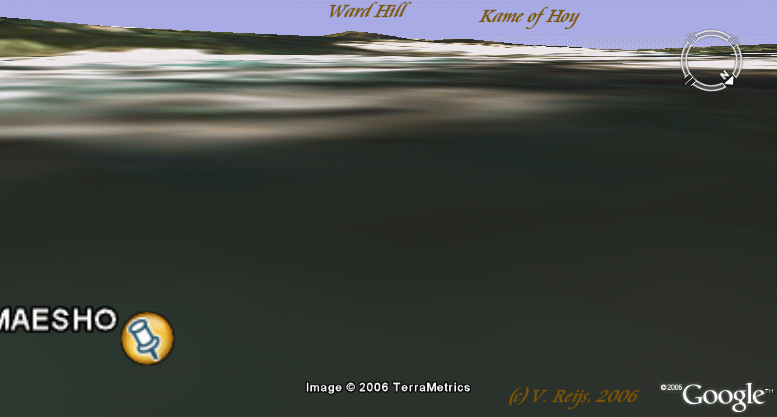
- Due to the above, skyline profiles in GE are very poor (when
using Tools -> Options -> 3D View -> Terrain Quality -> Higher):
Compare this with this one using a camera:
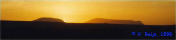
(my own VRML world provides a comparable picture as with the
camera)
The heights of the hills are around 450 m, the eye alt is
around
15 m
and distance some 12 km.
- I have the idea that terrestrial
refraction is not incorporated
in the
displaying of the scene when using tilt
slider. I think it would not be
difficult to include terrestrial
refraction.
- It seems that having one's eye
alt at say elev+2
m
(so a
person
standing on the ground) is not possible, the tilt slider is then not
really working.
When tilt slider is
fully at skyline view, eye
alt can't be made smaller then a certain value
(depending on the elev?),
and
this certain value is not near a person standing on the ground.
- There is no indication of the eye's direction (azimuth), it
would
be
important to have the azimuth (with at least one decimal) also
in the
status bar when rotating the navigation
ring
- It is important to see on the status bar also the eye's long
and
lat. Now one only sees these all for the mouse pointer.
- The status bar should also provide the azimuth and altitude
angles
of the mouse pointer with respect to the eye location.
- I think Google Earth has a good potential in the future, the
nice
thing is it looks to become more popular then VRML or X3D
products and
sometimes the
sheer amount of viewers will determine the direction of the
market and
the developments. So I think investing some time in this can be
important.
- So it would be great to have Google Earth providing an
accurate skyline, I don't expect that the people of GE will look
into
the above ideas very soon, but one never knows.
If people are willing to invest time in improving
this from an archaeocosmology/astronomy
point
of view, please let me
know. Or discuss it in the Google
Earth forum.
Disclaimer and Copyright
HomeUpSearchMail
Major content related changes: Oct. 21, 2006